Create: Update:
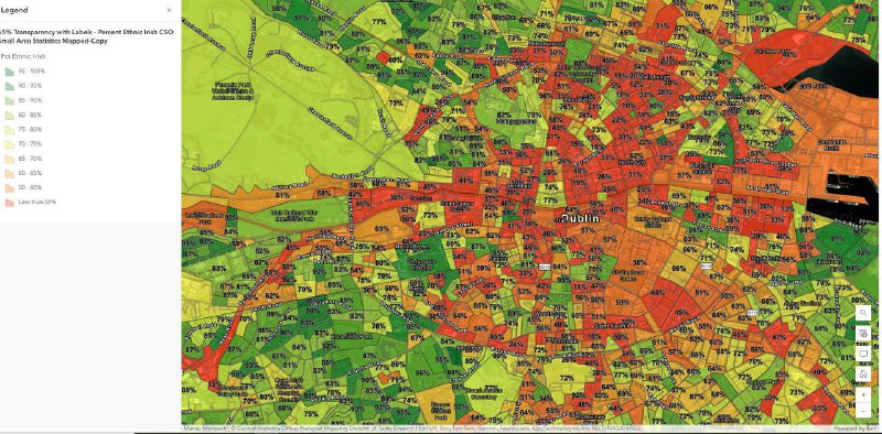
Ireland Mapped by Ethnic Irish, last Census.
Red is under 50% Ethnic Irish.
See Interactive Webmap here:
https://burninganalytics.maps.arcgis.com/apps/mapviewer/index.html?webmap=3aa985cf406c4d4180bfd6186b617546
https://x.com/jimbobfrazzled/status/1890959419485110643?s=46
And these are official figures which I don’t believe, it’s far worse. Just look at that interactive map. The orange & red zones are like a creeping cancer infecting our beautiful country.

>>Click here to continue<<
TruthGraphs